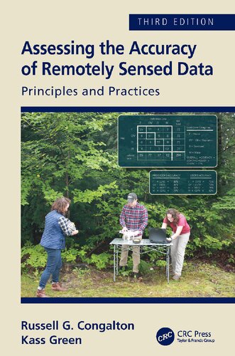
Assessing the accuracy of remotely sensed data principles and practices 3rd Edition by Kass Green, Russell Congalton ISBN 1498776663 9781498776660
$50.00 Original price was: $50.00.$25.00Current price is: $25.00.
Assessing the accuracy of remotely sensed data principles and practices 3rd Edition by Kass Green, Russell G. Congalton – Ebook PDF Instant Download/Delivery: 1498776663, 978-1498776660
Full download Assessing the accuracy of remotely sensed data principles and practices 3rd Edition after payment
Product details:
ISBN 10: 1498776663
ISBN 13: 978-1498776660
Author: Kass Green, Russell G. Congalton
The past 10 years have brought amazing changes to the technologies used to turn remotely sensed data into maps. As a result, the principles and practices necessary for assessing the accuracy of those maps have also evolved and matured. This third edition of Assessing the Accuracy of Remotely Sensed Data: Principles and Practices is thoroughly updated and includes five new chapters. Now 15 chapters long, this text is the only one of its kind to provide geospatial analysts with the requisite considerations, tools, and theory necessary to conduct successful and efficient map accuracy assessments; and map users with the knowledge to fully understand the assessment process to ensure effective use of maps.
See What’s New in the Third Edition:
- All original chapters have been updated to include new standards, practices, and methodologies.
- A new chapter on planning accuracy assessments.
- A new chapter on assessing maps created using object-based technologies.
- Two case study chapters – one showcasing the assessment of maps created from traditional methods, and one on the assessment of object-based maps.
- Emphasis on considering and planning for positional accuracy in concert with thematic accuracy.
- An appendix containing the internationally recognized ASPRS Positional Accuracy Standards.
- A new final chapter summarizing the key concepts, considerations and lessons learned by the authors in their decades of implementing and evaluating accuracy assessments.
Assessing map accuracy is complex; however, the discussions in this book, together with the many figures, tables, and case studies, clearly present the necessary concepts and considerations for conducting an assessment that is both is practical, statistically reliable, and achievable.
Assessing the accuracy of remotely sensed data principles and practices 3rd Table of contents:
Chapter 1: Introduction
- Why Map?
- Why Assess the Accuracy of a Map?
- Types of Map Accuracy Assessment
- Critical Steps in Accuracy Assessment
- Organization of the Book
Chapter 2: The History of Map Accuracy Assessment
- How Maps Are Made
- History of Accuracy Assessment
- Positional Accuracy Assessment
- Thematic Accuracy Assessment
Chapter 3: Planning for Conducting an Accuracy Assessment
- What Type of Assessment?
- Qualitative Accuracy Assessment
- Between Qualitative and Quantitative Assessment
- Similarity Analysis
- Error Budget
- Quantitative Accuracy Assessment
- Positional Accuracy Assessment
- Thematic Accuracy Assessment
- Why Do the Assessment?
- How Will the Assessment Be Used?
- What Special Considerations Exist?
- Conclusions
Chapter 4: Positional Accuracy
- Introduction
- What Is Positional Accuracy?
- Common Standards for Positional Accuracy
- Designing Positional Accuracy Assessment and Sample Selection
- How Is Positional Accuracy Analyzed?
- Review of Basic Statistics
- Parameters and Statistics
- Estimating the Dispersal of Variables
- Estimating a Confidence Interval around the Estimate of the Mean
- Statistics in Positional Accuracy Assessment
- If Errors Are Normally Distributed
- If Errors Are Not Normally Distributed
- How Is Positional Accuracy Reported?
- Summary
Chapter 5: Thematic Map Accuracy Basics
- Non-site-specific Assessments
- Site-specific Assessments
- The Error Matrix
- Overall, Producer’s, and User’s Accuracies
- Mathematical Representation of the Error Matrix
Chapter 6: Thematic Map Accuracy Assessment Considerations
- Thematic Map Classes to Be Assessed
- The Classification Scheme
- Other Data Considerations
- Continuous vs Non-Continuous Data
- Spatial Autocorrelation
- Appropriate Sample Unit
- Single Pixel
- Cluster of Pixels as a Single Sample Unit
- Polygon as Single Sample Unit
- Clusters of Sample Units
- How Many Samples Should Be Taken?
- Binomial Distribution
- Multinomial Distribution
- How Should the Samples Be Chosen?
- Sampling Schemes
- Sampling Scheme Considerations
- Equal vs Minimum vs Proportional Distribution
- Conclusions
Chapter 7: Reference Data Collection
- Source of the Reference Data
- Using Existing vs Newly Collected Data
- Remotely Sensed Data vs Field Visits
- How Should the Reference Data Be Collected?
- When Should the Reference Data Be Collected?
- Ensuring Objectivity and Consistency
- Data Independence
- Data Collection Consistency
- Quality Control
Chapter 8: Basic Analysis Techniques
- Kappa
- Margfit
- Conditional Kappa
- Weighted Kappa
- Compensation for Chance Agreement
- Confidence Limits
- Area Estimation/Correction
Chapter 9: Analysis of Differences in the Error Matrix
- Errors in the Reference Data
- Sensitivity of the Classification Scheme to Observer Variability
- Inappropriateness of the Remote Sensing Data Employed to Make the Map
- Mapping Error
- Summary
- Appendix 9.1: Forest and Woodland Map Class Key of Haleakalā National Park
Chapter 10: Fuzzy Accuracy Assessment
- Expanding the Major Diagonal of the Error Matrix
- Measuring Map Class Variability
- The Fuzzy Error Matrix Approach
- The Fuzzy Error Matrix
- Implementation of the Fuzzy Error Matrix
- Another Fuzzy Error Matrix Example
- Summary
Chapter 11: Object-Based or Polygon Accuracy Assessment
- What Sample Unit Should Be Used?
- Traditional Tally-based vs Area-based Error Matrix
- Comparison of the Two Error Matrix Approaches
- Reference Data Collection/Labeling
- Computing the Accuracy
- Conclusions
Chapter 12: An Object-based Accuracy Assessment Case Study
- Introduction
- Overview of the Case Study
- Accuracy Assessment
- Thematic Classes to Be Assessed
- Appropriate Sampling Unit
- How Many Samples Should Be Taken?
- How Samples Should Be Chosen
- Source of Reference Data
- How Reference Data Should Be Collected
- Ensuring Consistency and Objectivity in Data Collection
- Analysis
- Error Matrix and Its Use
- Statistical Properties and Analysis Techniques
- Fuzzy Accuracy and Fuzzy Accuracy Assessment
- Results
- Lessons Learned
Chapter 13: The California Hardwood Rangeland Project
- Introduction
- Background
- Sample Design
- Distribution of Map Information
- Appropriate Sample Unit
- Sample Size and Distribution
- Reference Data Collection
- Source and Type of Data
- When Data Should Be Collected
- Quality Control
- Analysis
- Development of Error Matrices
- Statistical Analysis
- Analysis of Off-diagonal Samples
- Crown Closure Analysis
- Crown Closure Map Results
- Cover Type Analysis
- Cover Type Map Results
- Discussion
- Conclusions
Chapter 14: Advanced Topics
- Change Detection
- Reference Data
- Sampling
- Change Detection Error Matrix
- Two-Step Approach to Change Detection Accuracy Assessment
- Case Study
- Step 1: Accuracy of the Change Areas
- Step 2: Change/No Change Assessment
- Multi-layer Assessments
Chapter 15: Summary and Conclusions
People also search for Assessing the accuracy of remotely sensed data principles and practices 3rd:
what is the test for accuracy
evaluating the accuracy of a classifier or predictor
assessing the reliability and validity of expert interviews
how to assess accuracy
bias accuracy and precision
Tags:
Kass Green,Russell Congalton,Assessing,accuracy,remotely,sensed data,principles,practices 3rd
You may also like…
Engineering
Biology and other natural sciences - Plants: Agriculture and Forestry
Science (General)
Earth Sciences - The Environment
Computer Processing of Remotely Sensed Images 5th Edition Paul M. Mather & Magaly M. Koch
Science (General)
Arts - Graphic Arts
Graphic Design School the Principles and Practices of Graphic Design Calvert
Computers - Organization and Data Processing


