Geospatial Practices in Natural Resources Management 2024th Edition Pravat Kumar Shit
$50.00 Original price was: $50.00.$25.00Current price is: $25.00.
This completed downloadable of Geospatial Practices in Natural Resources Management 2024th Edition Pravat Kumar Shit.
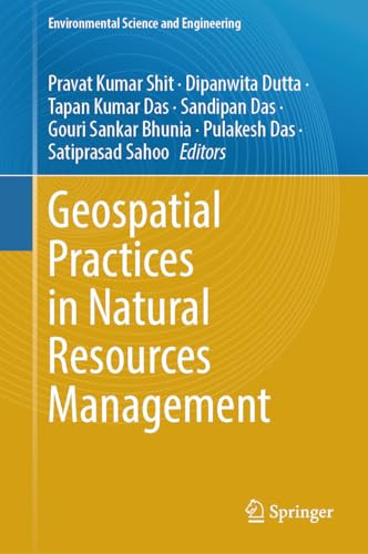
Instant downloaded Geospatial Practices in Natural Resources Management 2024th Edition Pravat Kumar Shit pdf docx epub after payment.
Product details:
- ISBN-10 : 3031380045
- ISBN-13 : 9783031380044
- Author : Pravat Kumar Shit, Dipanwita Dutta, Tapan Kumar Das, & 4 more
Table of contents:
Part I. Land Resources
1. Big Data Analysis for Sustainable Land Management on Geospatial Cloud Framework
2. Assessing of LULC and Climate Change in Kolkata Urban Agglomeration Using MOLUSCE Model
3. Field Survey and Geoinformatic Approaches for Micro-Level Land Capability Classification
4. Assessment of Potential Land Suitability for Economic Activity Using AHP and GIS Techniques in Drought Prone Gandheswari Watershed, Bankura District in West Bengal
5. Spatial–Temporal Changes of Urban Sprawl, LULC and Dynamic Relationship Between Land Surface Temperature (LST) and Bio-Physical Indicators: A Study of Kolkata Municipal Corporation, West Bengal
6. Spatio-Temporal Dynamics of Urban Land Use Applying Change Detection and Built-Up Index for Durgapur Municipal Corporation, Paschim Bardhaman, West Bengal
7. Studies on Impacts of Land Use/Land Cover Changes on Groundwater Resources: A Critical Review
Part II. Water Resources
8. Crowdsourcing as a Tool for Spatial Planning in Water Resource Management
9. Spatio-Seasonal Runoff and Discharge Variability in the Ganga River Basin, India: A Hydrometeorological Perspective
10. Appraisal of Drinking Water Quality of Kalahandi District Using Geospatial Technique
11. Allocation of Potential Tourism Gradient Sites at Maithon Dam of Damodar Valley Corporation (DVC), India: A Geospatial Approach
12. Watershed Management Process Under MGNREGA: An Approach to Natural Resource Management Through People’s Participation
13. Meteorological and Agricultural Drought Monitoring Using Geospatial Techniques
14. GIS Based Delineation of Flood Susceptibility Mapping Using Analytic Hierarchy Process in East Vidarbha Region, India
15. Fluoride Contamination in Groundwater—A Review
16. Analysis of Basin Morphometry for the Prioritization Using Geo-Spatial Techniques: A Case Study of Debnala River Basin, Jharkhand, India
17. Geo-Spatial Techniques to Analyze Fluvial Morphometry of River Kangshabati and Some Associated Features, in Selected Parts of Bankura District, West Bengal
18. Morphometric Analysis of Panzara River Basin Watershed, Maharashtra, India Using Geospatial Approach
19. Groundwater Geochemistry and Identification of Hydrogeochemical Processes of Fluoride Enrichment in the Consolidated Aquifer System in a Rain Shadow Area of South India
Part III. Forest Resources
20. Temporal Areal and Greenness Variation of Marichjhapi Island, Sundarban, India
21. Estimation of Crop Coefficients Using Landsat-8 Remote Sensing Image at Field Scale for Maize Crop
22. Spatio-Temporal Assessment of Forest Health Dynamics of Sikkim Using MODIS Satellite Data by AHP Method and Geospatial Techniques
23. Forest Degradation Susceptibility and Sustainability: Case Study of Arganeraie Biosphere Reserve, Atlantic High Atlas, Morocco
24. Utilization of PISA Model and Deduced Specific Degradation Over Semi-arid Catchment: Case of Abdelmomen Dam in Souss Basin (Morocco)
25. Geospatial Practices for Airpollution and Meteorological Monitoring, Prediction, and Forecasting
26. Empowerment of Geospatial Technologies in Conjunction with Information and Communication Technologies (ICT)
People also search:
will natural resources last forever
what is geospatial research
is natural resources physical geography
are natural resources part of geography
what does the national geospatial-intelligence agency do
You may also like…
Business & Economics - Industries
Engineering
Engineering
Thermodynamics for Sustainable Management of Natural Resources 1st Edition Wojciech Stanek (Eds.)
Business & Economics - Mathematical Economics


