Processing Of Remote Sensing Data First Edition Hazel 9058092321 9789058092328
$50.00 Original price was: $50.00.$25.00Current price is: $25.00.
This completed downloadable of Processing Of Remote Sensing Data First Edition Hazel B. Girard
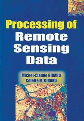
Instant downloaded Processing Of Remote Sensing Data First Edition Hazel B. Girard pdf docx epub after payment.
Product details:
- ISBN-10 : 9058092321
- ISBN-13 : 9789058092328
- Author: Hazel B. Girard
Containing useful information sources for the management of natural resources, this comprehensive text covers a large range of spatial resolutions and spectral characteristics. The book deals with the data sources and their physical interpretation, as well as processing techniques, such as visual interpretation and automated classifications, textural and structural processing and photogrammetry. There is a section on accuracy assessment and various applications relating to crops, grasslands, soils, landscapes, mines and coasts. The CD-ROM contains software and image data sets explaining the statistical methods of reference and contains a light version of the TeraVue software enabling the reader to compute the different processing spatial data.
Table of contents:
Part A|54 pages
Chapter 1|30 pages
Physical Basis
Chapter 2|22 pages
Sensors and Platforms
Part B|38 pages
Physical Interpretation of Data
Chapter 3|15 pages
Composition of Colours
Chapter 4|21 pages
Spectral Characteristics
Part C|187 pages
Processing and Interpretation
Chapter 5|18 pages
Visual Interpretation of Photographs and Images
Chapter 6|8 pages
Image Processing—General Features
Chapter 7|23 pages
Preliminary Processing
Chapter 8|23 pages
Unsupervised Classification
Chapter 9|20 pages
Supervised Classification
Chapter 10|6 pages
Image Processing Methodology
Chapter 11|15 pages
Structural Processing of Satellite Images
Chapter 12|26 pages
Digital Filtering of Images
Chapter 13|21 pages
Geometric Transformation of Remote-sensing Images
Chapter 14|26 pages
Fundamentals of Aerial Photography
Part D|29 pages
Quality Assessment
Chapter 15|10 pages
Scale Changes
Chapter 16|7 pages
Criteria of Choice for the User
Abstract
Chapter 17|13 pages
Quality of Interpretation
Abstract
Part E|139 pages
Applications
Chapter 18|18 pages
Agrolandscapes
Chapter 19|14 pages
Corine Land Cover
Chapter 20|14 pages
Herbaceous Formations and Permanent Grasslands
Chapter 21|12 pages
Wetlands
Chapter 22|7 pages
Crop Inventory
Chapter 23|23 pages
Soil Mapping
Chapter 24|13 pages
Mining Geology
Chapter 25|16 pages
Remote Sensing and Coastal-zone Management
Chapter 26|20 pages
Applications of Thermal-infrared and Microwave Data
People also search:
what is remote sensing data
remote sensing data examples
how are remote sensing data commonly used
data processing in remote sensing
remote sensing data processing and application
You may also like…
Engineering
Image processing and GIS for remote sensing : techniques and applications Second Edition Liu
Computers - Programming
Multisensor Image Fusion and Data Mining for Environmental Remote Sensing First Edition Bai
Computers - Programming
Remote Sensing of Hydrometeorological Hazards First Edition George P. Petropoulos
Computers - Programming
Computers - Programming
Biology and other natural sciences - Plants: Agriculture and Forestry


